What does the journey from satellite image to carbon credit look like?
A carbon project may begin with something as simple as a piece of land, but turning that land into a credible carbon project involves multiple stages of assessment, planning, monitoring and verification. Technologies such as satellite imagery, GIS, artificial intelligence and digital MRV are helping project developers make the process more efficient and traceable. The journey has eight steps.
Step 1: How do you identify and assess the land?
The first step is understanding the land. Satellite imagery and GIS can help identify land boundaries, existing vegetation, historical land use and surrounding landscape conditions, which helps developers judge whether an area may suit a particular carbon project activity. But satellite data is only one part of the assessment: ground-level information and supporting documentation matter too.
Step 2: How do you assess project eligibility?
Once a potential site has been identified, it needs to be assessed against the requirements of the selected carbon standard and methodology. This may involve evaluating:
- Land-use history
- Existing vegetation
- Project boundaries
- Eligibility requirements
- Baseline conditions
- Additionality
- Leakage risks
- Permanence considerations
This stage matters because not every piece of land is automatically suitable for carbon project development.
Step 3: How do you design the plantation or restoration activity?
The next question is what should actually be implemented on the land. Species selection, planting density, spatial arrangement and management practices all influence future carbon sequestration, and the design should balance carbon objectives with ecological conditions, biodiversity and local requirements.
Step 4: How is carbon sequestration estimated?
Once the design is established, sequestration can be estimated using appropriate methodologies, models and growth assumptions. The objective is to estimate how much additional carbon the project could store over the crediting period. This is where scientific modelling becomes critical: the number should not simply be based on the number of trees planted.
Step 5: Why does field data still matter?
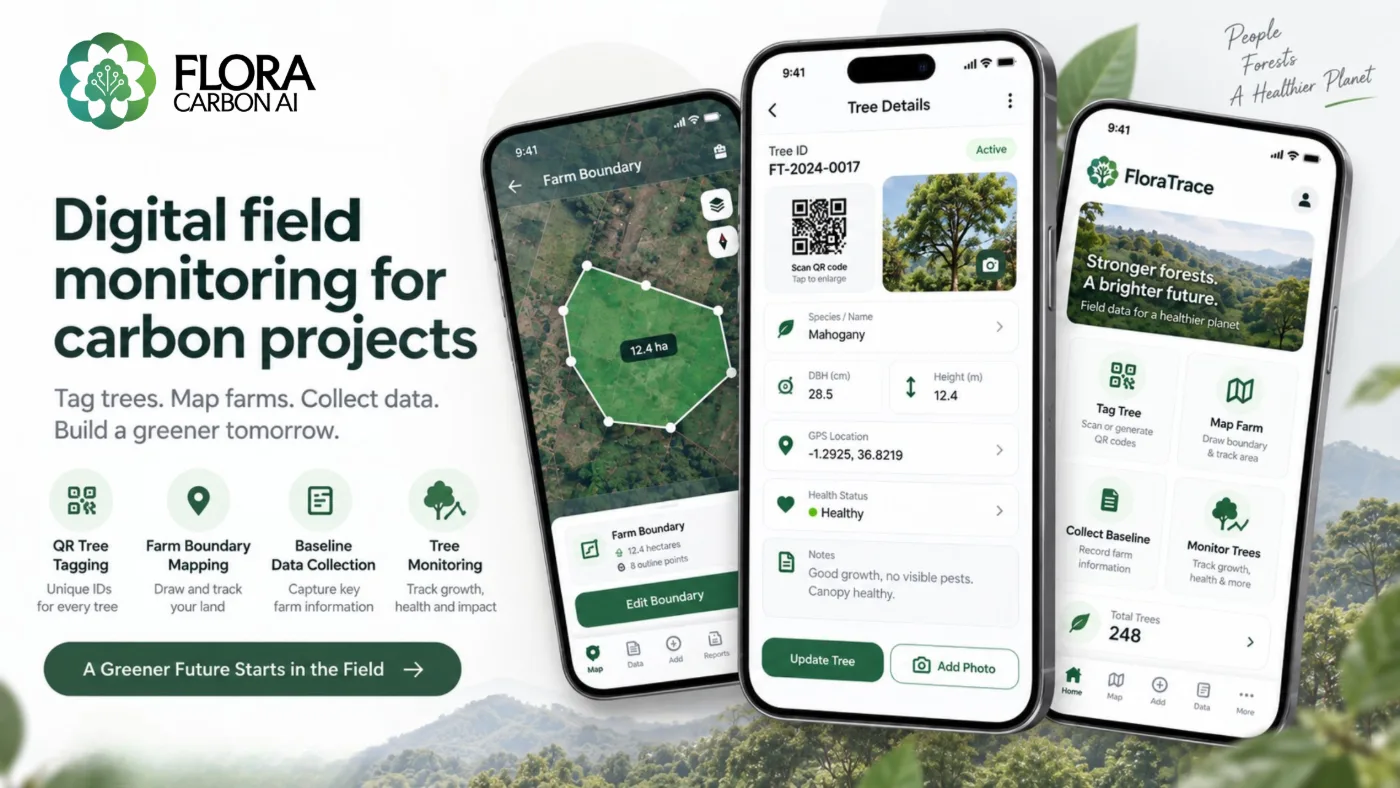
Remote sensing provides a powerful overview, but field data remains essential. Species, planting locations, tree survival, growth and other relevant parameters can be collected during field surveys, and digital field-data systems make that information easier to organise and update.
Step 6: How do you monitor the project over time?
A carbon project does not end after planting. Trees grow, some die, new trees may be planted, land conditions change and environmental events can affect the project. Regular monitoring shows what is actually happening on the ground, and combining satellite data with field observations gives a more complete picture of progress.
Step 7: What is a traceable MRV system?
Measurement, Reporting and Verification (MRV) is at the centre of credible carbon projects. A digital MRV system can connect the project area to field data, field data to individual trees, trees to biomass estimates, biomass estimates to carbon calculations, and those calculations to reports. This creates a clearer data trail and can reduce dependence on fragmented spreadsheets and manual records.
Step 8: How do verification and credit issuance work?
After the required documentation and monitoring processes are completed, the project goes through the validation and verification processes of the applicable carbon standard. If it meets the required conditions, verified emission reductions or removals can eventually be issued as carbon credits.
Where does Flora Carbon AI fit in?
We are building technology to simplify different stages of this workflow:
- FloraScope helps with land screening and spatial assessment.
- FloraCarbon supports carbon quantification and sequestration assessment.
- Carbon Intel helps prepare project documentation while keeping supporting references connected to claims.
- FloraTrace focuses on field-level and tree-level records, helping improve monitoring and traceability.
Together, these are designed to connect different parts of the carbon project lifecycle. See all five modules on the products page.
What is the future of carbon project development?
The carbon market is becoming increasingly data-driven, but the future is not simply about using more technology. It is about using technology to make carbon projects more transparent, scalable, scientifically robust and easier to monitor. A satellite image may be where the journey starts, but a credible carbon credit requires much more: good science, reliable data, strong project design, continuous monitoring and transparent MRV.
To see why the early steps decide so much, read Why Carbon Projects Struggle Before the First Tree Is Planted.